Hi Community
In this article, I will demonstrate the functionality of my app iris-geo-map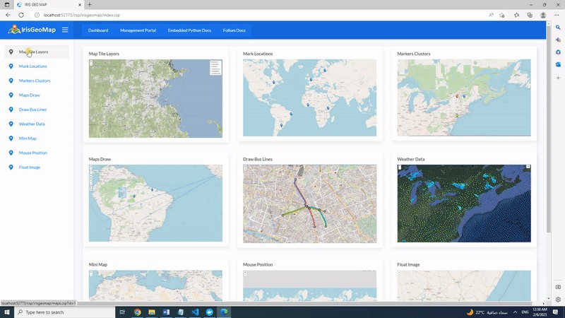
IRIS Geo Map application is a tool to visualize geographic data by generating interactive maps by using Embedded Python functionality. Application is using Folium Python library
folium builds on the data wrangling strengths of the Python ecosystem and the mapping strengths of the leaflet.js library. Manipulate your data in Python, then visualize it in on a Leaflet map via folium. folium makes it easy to visualize data that’s been manipulated in Python on an interactive leaflet map.
.png)